
Tippecanoe County
Counties: Tippecanoe County
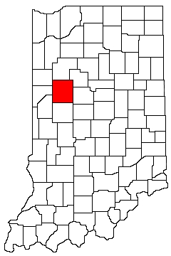
Tippecanoe County is in northwest Indiana. It is bounded on the north by White County, on the northeast by Carroll County, on the west by Benton County, Warren County, and Fountain County, on the south by Montgomery County, and on the east by Carroll County and Clinton County.
Natural Areas
Beineke Memorial Forest
NICHES
Clegg Memorial Gardens
See also: NICHES
Granville Sand Barrens
See also: NICHES ·
DNR [PDF]
Hare Bend of the Wabash
NICHES
Mulvey Pond
See also: NICHES
Parker's Indian Creek Basin
NICHES
Potawatomi Trail
NICHES
Prophetstown Fen NP
DNR [PDF]
Prophetstown State Park
See also: DNR
Wabash Bottoms Janssen Tract
NICHES
Wabash Heritage Trail
Coming Soon
Wise Island
NICHES
Organizations
Indiana Native Plant Society - West Central Chapter
Watersheds
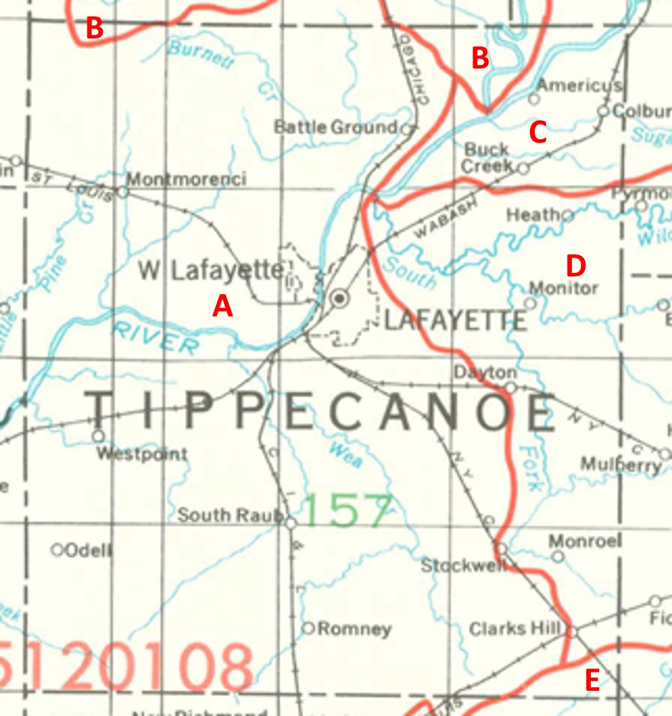
Tippecanoe County Watersheds
Click to enlarge
Red lines on the map depict the boundaries of 8-digit hydrologic units (one convenient definition of a watershed) as shown on this 1974 United States Geological Survey Map.
Tippecanoe County drains into five different 8-digit hydrologic units, each represented on the image above by an area between red lines and within the county boundary, designated by a letter. Clicking on a watershed name below will take you to separate page with more information on that watershed.
Letter |
Watershed |
A |
Middle Wabash-Little Vermillion |