
Posey County
Counties: Posey County
Posey County is in extreme southwest Indiana. It is bounded on the north by Gibson County, on the west by Illinois, on the south by Kentucky, and on the east by Vanderburgh County.
Natural Areas
Goose Pond Cypress Slough
NC
Harmonie Hills Nature Preserve
DNR [PDF]
Harmonie State Park
See also: DNR
Point Township Complex
NC
Section Six Flatwoods
See also: DNR [PDF]
Twin Swamps Nature Preserve
See also: DNR [PDF]
Wabash Border Nature Preserve
DNR [PDF]
Wabash Lowlands Nature Preserve
DNR [PDF]
Organizations
Indiana Native Plant Society - Southwest Chapter
Watersheds
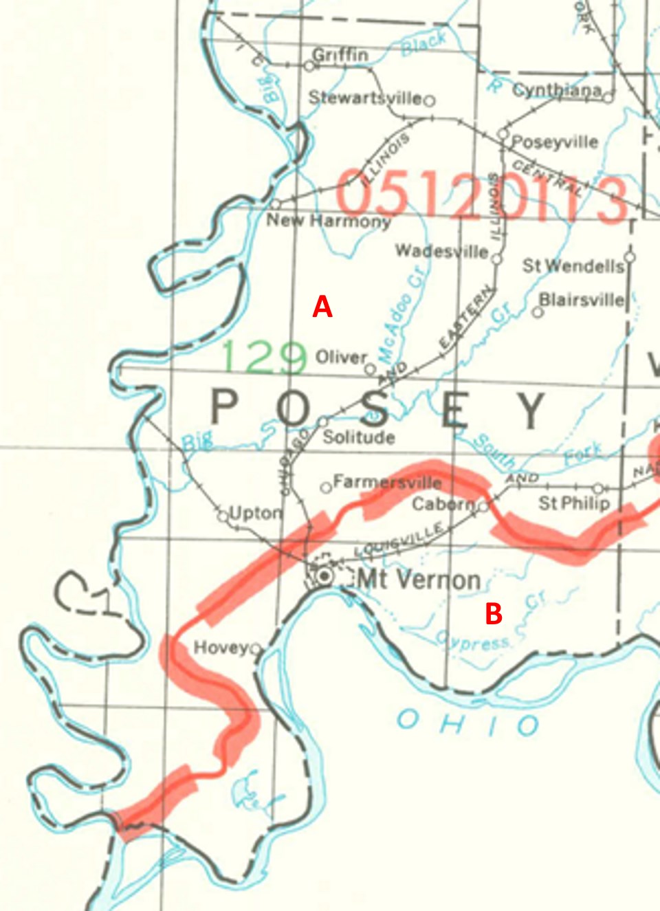
Posey County Watersheds
Click to enlarge
Red lines on the map depict the boundaries of 8-digit hydrologic units (one convenient definition of a watershed) as shown on this 1974 United States Geological Survey Map.
Posey County drains into two different 8-digit hydrologic units, each represented on the image above by an area between red lines and within the county boundary, designated by a letter. Clicking on a watershed name below will take you to separate page with more information on that watershed.
Letter |
Watershed |
A |