
Highland-Pigeon Watershed
Watersheds: Highland-Pigeon
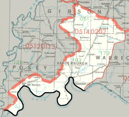
Highland-Pigeon Watershed
Click to enlarge
The Highland-Pigeon Watershed drains much of Vanderburgh County and substantial parts of Gibson County, Posey County, and Warrick County, as well as a small portion of the southwestern-most corner of Pike County. The watershed drains about 337,000 acres in Indiana, and almost as many in Kentucky.
County |
Acreage |
Source: USDA
Pigeon Creek is the largest stream in the Indiana portion of the watershed; it enters the Ohio River at Evansville. Tributaries of Pigeon Creek include Locust Creek, Little Pigeon Creek (not the same Little Pigeon Creek that joins the Ohio River southeast of Newburgh), Firlick Creek, Bluegrass Creek, Hurricane Creek, and Big Creek. Many other smaller watercourses in the Indiana portion of this watershed, like Bayou Creek, Eagle Creek, and Frenchman's Slough, drain directly into the Ohio River without joining Pigeon Creek.
After entering the Ohio River, water from this watershed continues to the Mississippi River before discharging into the Gulf of Mexico.
The United States Geological Survey has assigned the Highland-Pigeon Watershed an 8-Digit Hydrologic Unit Code of 05140202.