
Lower Wabash Watershed
Watersheds: Lower Wabash
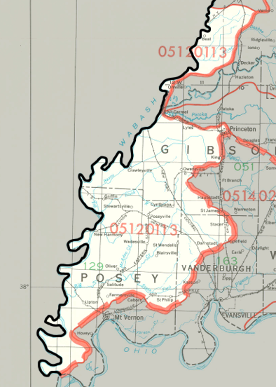
Lower Wabash Watershed
Click to enlarge
The Lower Wabash Watershed straddles the Wabash River in southwest Indiana and southeast Illinois. It drains most of Posey County and parts of Pike County and Vanderburgh County. Several smaller watercourses on the Indiana side of this watershed drain into the Wabash River, including Big Creek and the Black River. The watershed drains about 426,000 acres of Indiana, and a slightly smaller area of Illinois.
County |
Acreage |
Source: USDA
The Wabash River flows into the Ohio River. The Ohio River joins the Mississippi River, which empties into the Gulf of Mexico.
The United States Geological Survey has assigned the Lower Wabash Watershed an 8-Digit Hydrologic Unit Code of 05120113.