
Parke County
Counties: Parke County
Parke County is in west central Indiana. It is bounded on the north by Fountain County, on the west by Vermillion County, on the south by Vigo County and Clay County, on the east by Putnam County, and on the northeast by Montgomery County.
Natural Areas
Hare Preserve at Turtle Bend
CILTI
Mossy Point Nature Preserve
CILTI ·
NC ·
DNR [PDF]
Raccoon SRA
DNR
Rocky Hollow-Falls Canyon NP
DNR [PDF]
Turkey Run State Park
See also: DNR
Organizations
Indiana Native Plant Society - West Central Chapter
Watersheds
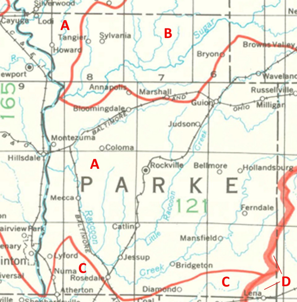
Parke County Watersheds
Click to enlarge
Red lines on the map depict the boundaries of 8-digit hydrologic units (one convenient definition of a watershed) as shown on this 1974 United States Geological Survey Map.
Parke County drains into four different 8-digit hydrologic units, each represented on the image above by an area between red lines and within the county boundary, designated by a letter. Clicking on a watershed name below will take you to separate page with more information on that watershed.
Letter |
Watershed |
A |
Middle Wabash-Little Vermillion |