
Southern Eel Watershed
Watersheds: Southern Eel
Southern Eel Watershed
Click to enlarge
Apparently there is a name shortage, so Indiana has two Eel Rivers. They are not directly connected to each other, yet many sources refer to the northern Eel River as the "Upper Eel River" and the southern Eel River as the "Lower Eel River". This seems inconsistent with the typical usage of "upper" and "lower" as referring to the upstream and downstream reaches of the same watercourse and so, in defiance of the authorities, EcoIndiana uses the terms northern and southern to differentiate between the two Eel Rivers. Now that that's over with...
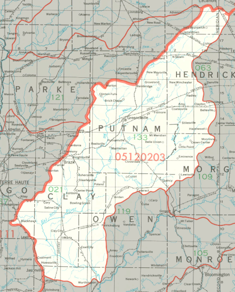
The Southern Eel Watershed drains about 770,000 acres in west central Indiana, including most of Clay County and Putnam County, large portions of Hendricks County and Owen County, and smaller parts of six other counties.
County |
Acreage |
Source: USDA
Notable tributaries of the southern Eel River include Lick Creek, Birch Creek, Jordan Creek, Croys Creek, Mill Creek, and Big Walnut Creek. The southern Eel River joins the White River near Worthington, in Greene County. The White River joins the Wabash River, which flows into the Ohio River and thence into the Mississippi River and on to the Gulf of Mexico.
The United States Geological Survey has assigned the Southern Eel Watershed an 8-Digit Hydrologic Unit Code of 05120203.