
Middle Wabash-Busseron Watershed
Watersheds: Middle Wabash-Busseron
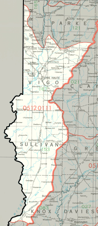
Middle Wabash-Busseron Watershed map
Click to enlarge
The Middle Wabash-Busseron Watershed straddles the Illinois-Indiana border. The Indiana portion is in the west central portion of the state, and drains about 719,000 acres. It drains most of Sullivan County and Vigo County, and small portions of four other Indiana counties. The smaller watercourses in this watershed, including Brouilletts Creek, Sulphur Creek, Honey Creek, and Busseron Creek, drain into the Wabash River.
County |
Acreage |
Source: USDA
The Wabash River flows into the Ohio River. The Ohio then joins the Mississippi River, which empties into the Gulf of Mexico.
The United States Geological Survey has assigned the Lower Wabash-Busseron Watershed an 8-Digit Hydrologic Unit Code of 05120111.