
Turkey Run
State Park
Natural Areas: Turkey Run State Park
Contains a National Natural Landmark [1974]
Trail. Click to enlarge
Turkey Run is one of Indianaĺs most remarkable state parks. It is also very popular, which means that you are likely to have company ľ perhaps lots of it ľ even on less-travelled paths. Sugar Creek flows west through the park, dividing it into northern and southern sections. The south features an inn, cabins, pool, and so on. Rocky Hollow-Falls Canyon Nature Preserve lies north of the creek. Pedestrian access to the preserve is via an impressive suspension bridge, just north of the Nature Center.
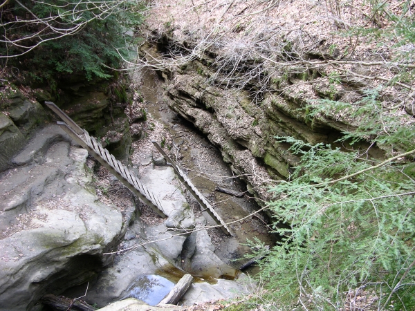
Ladders. Click to enlarge
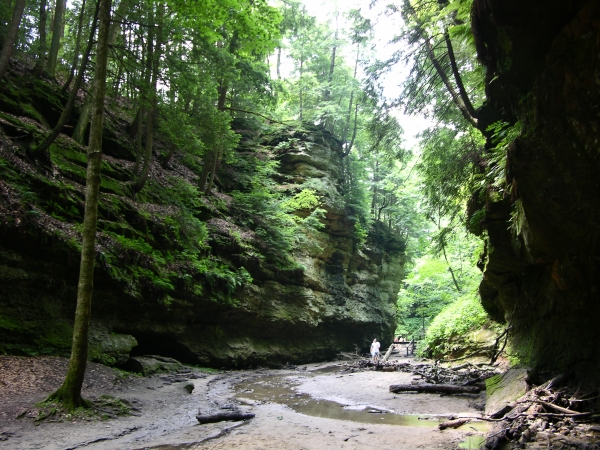
Once across the creek, turn left and look for the entrance to Trail 3; it will be on your right. Itĺs the most popular trail in the park, and with good reason. The tread is not always evident; it follows a creek upstream through Rocky Hollow, and there will be stretches in which youĺll need to pick your way through loose rubble or over slick water-smoothed rock. The experience is worth it; youĺll pass incredible cliffs and overhangs, and large rocks encrusted with ferns and other shade-tolerant vegetation. A giant triangular fragment named Wedge Rock rests on the canyon floor at the junction of two valleys. Not far beyond, youĺll find yourself in the Punch Bowl, a deep round formation graced with a waterfall. From here, you can follow Trail 4 further up canyon, or continue along Trail 3 as it turns west and eventually descends via two ladders into the very narrow northern end of Bear Hollow. Trail 9 is more remote but worth it. Youĺll pass many large trees and visit Boulder Canyon, which sports nice cliff faces, then negotiate the challenging scramble through an occasionally narrow and slick Falls Canyon.
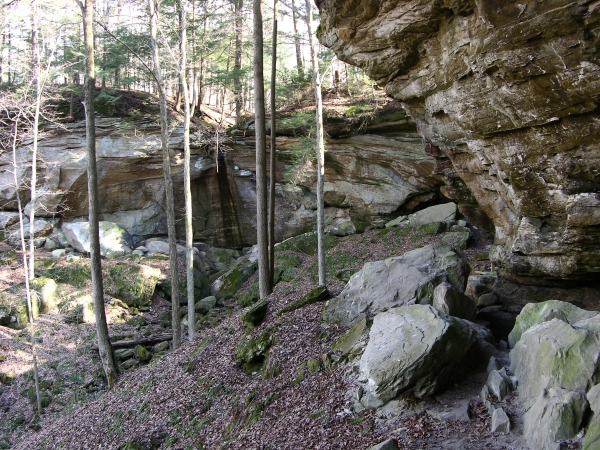
Gypsy Gulch. Click to enlarge
Donĺt neglect the south side of Sugar Creek. Trail 6 follows the bottom of a spectacular canyon just west of the Inn, and in the process connects with Trail 7, a delightful path that skirts the base of a massive sandstone cliff and passes large hemlock trees. The Box Canyon and especially Gypsy Gulch along Trail 2 are definitely worth the effort. Even the relatively sedate portion of Trail 1 along the southern bank of Sugar Creek offers pleasant scenery and is home to large stands of Virginia bluebell in the spring. If pressed for time, consider saving Trails 8 and 10 (north side) for last; though both would be very good in other parks.
Directions
Parke County. From the intersection of US 41 and IN 47, east 1.8 miles on IN 47 to the entrance on the left. From Crawfordsville, west on IN 47 to Waveland, then 8.6 miles further to entrance on right. (Fee)
GPS: N 39 52.942 W 87 12.116
Facilities
Inn, cabins, nature center, campground, many others
Finder Sketch

Click to enlarge
Nearby Natural Areas (miles)
Shades State Park (10.8)