
Clark County
Counties: Clark County
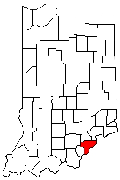
Clark County is in southern Indiana. It is bounded on the north by Scott County and Jefferson County, on the west by Washington County and Floyd County, on the south by Floyd County and Kentucky, and on the east by Kentucky.
Natural Areas
Charlestown State Park
See also: DNR
Chelsea Flatwoods
See also: NC
Clark State Forest
DNR
Deam Lake State Recreation Area
See also: DNR
Falls of the Ohio State Park
See also: DNR
Fourteenmile Creek Nature Preserve
DNR [PDF]
Knobstone Trail
DNR
Nine Penny Branch Nature Preserve
See also: DNR [PDF]
White Oak Nature Preserve
See also: DNR [PDF]
Organizations
Indiana Native Plant Society - South Central Chapter
Watersheds
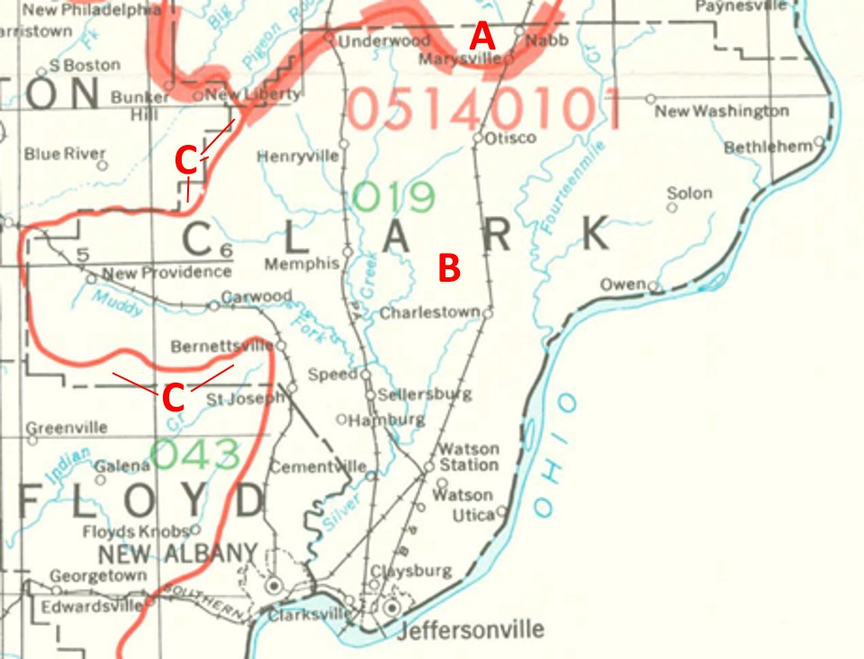
Clark County Watersheds
Click to enlarge
Red lines on the map depict the boundaries of 8-digit hydrologic units (one convenient definition of a watershed) as shown on this 1974 United States Geological Survey Map.
Clark County drains into three different 8-digit hydrologic units, each represented on the image above by an area between red lines and within the county boundary, designated by a letter. Clicking on a watershed name below will take you to separate page with more information on that watershed.
Letter |
Watershed |
A |