
Muscatatuck Watershed
Watersheds: Muscatatuck
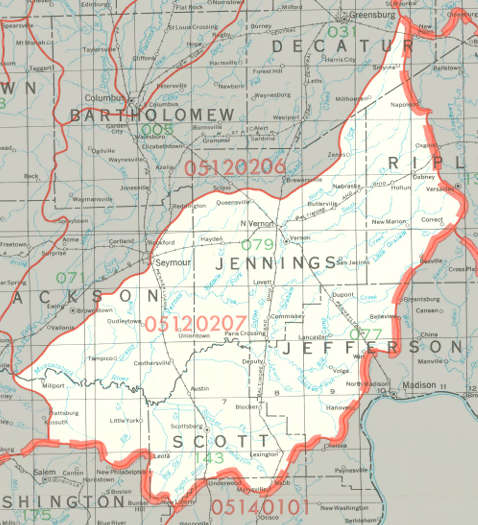
Muscatatuck Watershed
Click to enlarge
The Muscatatuck Watershed drains about 730,000 acres in southeastern Indiana, including most of Jennings County and Scott County, large portions of Jackson County, Jefferson County, and Ripley County, and smaller parts of three other counties.
County | Acreage |
Clark |
3,794 |
Source: USDA
The Muscatatuck River has many tributaries, including Mill Creek, Delaney Creek, Pond Creek, Graham Creek, and Big Creek. The Muscatatuck River joins the East Fork of the White River about ten miles north-northwest of Salem, Indiana. The East Fork of the White River joins the White River, which in turn flows into the Wabash River. The Wabash River joins the Ohio River, which flows into the Mississippi River and from there into the Gulf of Mexico.
The United States Geological Survey has assigned the Muscatatuck Watershed an 8-Digit Hydrologic Unit Code of 05120207.