
Silver-Little Kentucky Watershed
Watersheds: Silver-Little Kentucky
Silver-Little Kentucky Watershed
Click to enlarge
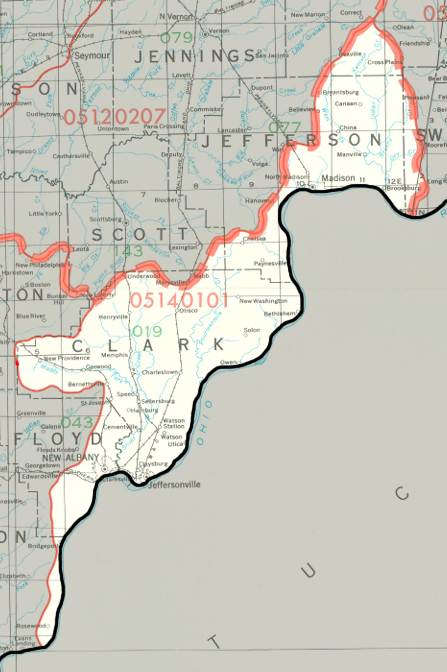
The Silver-Little Kentucky Watershed drains about 430,000 acres in southeastern Indiana and about 375,000 acres in Kentucky. The watershed is centered around the Ohio River, which accepts waters from many smaller creeks, including (on the Indiana side of the Ohio) Indian Kentuck Creek, Big Clifty Creek, Fourteenmile Creek, and Knob Creek. The watershed drains most of Clark County, large portions of Jefferson County, and parts of six other Indiana counties.
County |
Acreage |
Source: USDA
After joining the Ohio River, waters from the Silver-Little Kentucky Watershed flow into the the Mississippi River and on to the Gulf of Mexico.
The United States Geological Survey has assigned the Silver-Little Kentucky Watershed an 8-Digit Hydrologic Unit Code of 05140101.