
Tolleston Dunes
Natural Areas: Tolleston Dunes
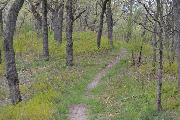
Path. Click to enlarge
Formerly Inland Marsh. A nice oak savanna with wet areas interspersed; trails pass over dunes formed millennia ago when the water level in Lake Michigan was much higher. Aside from the large paved parking lot and signage there are no facilities. A sandy trail heads south from the parking area, passing scattered trees and prickly pear cactus. After about a half mile, the trail turns west and climbs a short dune before connecting with a figure eight that winds its way over and between a series of dunes covered with oak savanna and intervening wetlands. Look for lupine, blue-eyed Mary, and wild columbine in May; bracken fern will be abundant later in the year. Highway, train, and aircraft noise can be annoying, but you’re not likely to encounter many pedestrian visitors.
Trail Map
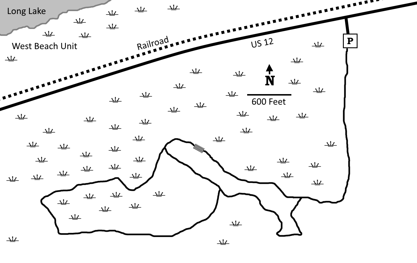
Click to enlarge
Directions
Porter County. From the intersection of US 12 and IN 249, west 2 miles on US 12 to well-marked parking area on the south side of the road.
GPS: N 41 36.967 W 87 11.575
Facilities
None
Finder Sketch
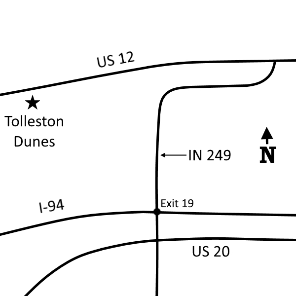
Click to enlarge
Nearby Natural Areas (miles)
Coulter Nature Preserve (2.2)
West Beach (2.7)
Miller Woods (4.6)
Cowles Bog (6.4)
Little Calumet River Trail (6.4)
Cressmoor Prairie (8.2)
Greiner Nature Preserve (8.7)
Indiana Dunes State Park (8.9)
Glenwood Dunes Trail (9.9)
Meadowbrook Nature Preserve (11.2)
Kemil Beach (11.7)
Great Marsh (12)
Ivanhoe South Nature Preserve (12)
Bur Oak Nature Preserve (12.2)
Moraine Nature Preserve (14.6)
Mount Baldy (16.2)
Gibson Woods (17)
Hoosier Prairie (19)
Bluhm County Park (19.9)