
Upper White Watershed
Watersheds: Upper White
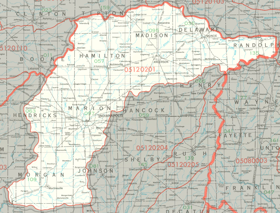
Upper White Watershed
Click to enlarge
The Upper White Watershed drains about 1.74 million acres, all in Indiana, and mostly in central Indiana. It drains all of Hamilton County, most of Delaware County, Hendricks County, Madison County, Marion County, and Morgan County, and parts of eleven other counties.
County |
Acreage |
Source: USDA
Notable tributaries of the Upper White River include White Lick Creek, Eagle Creek, Fall Creek, Cicero Creek, Killbuck Creek, and Buck Creek. After joining the Wabash, waters from the White River make their way to the Ohio River and thence into the Mississippi River and on to the Gulf of Mexico.
The United States Geological Survey has assigned the Upper White Watershed an 8-Digit Hydrologic Unit Code of 05120201.