
Upper Wabash Watershed
Watersheds: Upper Wabash
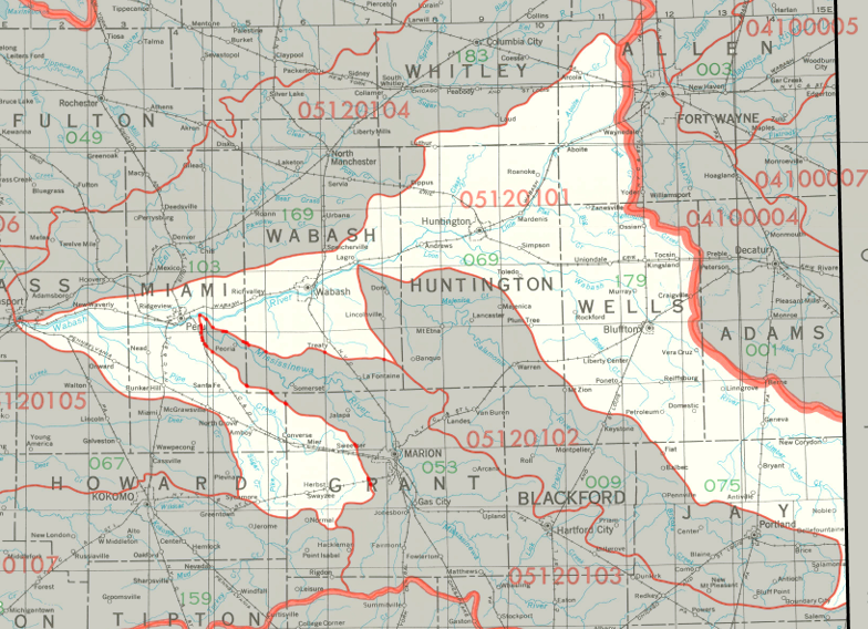
Upper Wabash Watershed
Click to enlarge
The Upper Wabash Watershed drains more than a million acres, about 852,000 of which are in Indiana, with the rest in Ohio. The watershed is centered around the Wabash River, which starts in Ohio and flows northwest to Huntington before turning west southwest toward Logansport, where the Upper Wabash watershed ends. The Upper Wabash watershed drains most of Huntington County and Wells County, as well as smaller portions of nine other Indiana counties.
County |
Acreage |
Source: USDA
Notable tributaries of the Upper Wabash River include Pipe Creek, the Mississinewa River, the Salamonie River, Rock Creek, and Loblolly Creek. The Wabash River joins the Ohio River, which then flows into the Mississippi River, and on to the Gulf of Mexico.
The United States Geological Survey has assigned the Upper Wabash Watershed an 8-Digit Hydrologic Unit Code of 05120101.