
Allen County
Counties: Allen County
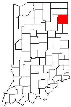
Allen County is in northeast Indiana. It is bounded on the north by Noble County and DeKalb County, on the west by Whitley County and Huntington County, on the south by Wells County and Adams County, and on the east by Ohio.
Natural Areas
Arrowhead Preserves
LRWP
Bicentennial Woods
See also: ACRES À
DNR [PDF]
Blue Cast Springs
See also: ACRES À
DNR [PDF]
Buttonbush Bottoms
LRWP
Dustin Nature Preserve
See also: ACRES À
DNR [PDF]
Eagle Marsh
See also: LRWP
Fogwell Forest
See also: ACRES
Foxfire Woods
Slated for Closure by the end of 2024. See ACRES link for details.
See also: ACRES À
DNR [PDF]
Fox Island County Park
See also: DNR [PDF]
Lindenwood Nature Preserve
DNR [PDF]
McNabb-Walter Nature Preserve
See also: ACRES À
DNR [PDF]
Mengerson Nature Preserve
See also: ACRES À
DNR [PDF]
Meno-Aki Nature Preserve
DNR [PDF]
Spring Lake Woods & Bog Nature Preserve
See also: ACRES À
DNR [PDF]
Vandolah Nature Preserve
See also: ACRES À
DNR [PDF]
Organizations
Indiana Native Plant Society - Northeast Chapter
Watersheds
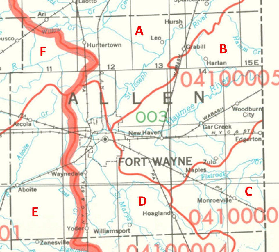
Allen County Watersheds
Click to enlarge
Red lines on the map depict the boundaries of 8-digit hydrologic units (one convenient definition of a watershed) as shown on this 1974 United States Geological Survey Map.
Allen County drains into six different 8-digit hydrologic units, each represented on the image above by an area between red lines and within the county boundary, designated by a letter. Clicking on a watershed name below will take you to separate page with more information on that watershed.
Letter |
Watershed |
A |
St Joseph-Maumee |