
Driftwood Watershed
Watersheds: Driftwood
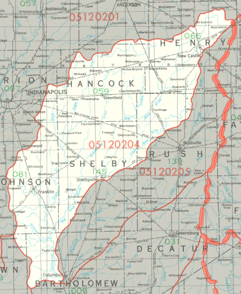
Driftwood Watershed
Click to enlarge
The Driftwood Watershed extends from much of Henry County, including New Castle, down to northwestern Bartholomew County. It drains most of Hancock County and large portions of Johnson County, Rush County, and Shelby County. It drains about 745,000 acres, all in Indiana.
County |
Acreage |
Source: USDA
The Big Blue River, Sugar Creek, Brandywine Creek, and Duck Creek are all part of the Driftwood Watershed. Summit Lake at Summit Lake State Park was created by damming the Big Blue River.
The Driftwood River flows into the Flatrock River, which joins the East Fork of the White River, and continues to the White River, Wabash River, Ohio River and Mississippi River before discharging into the Gulf of Mexico.
The United States Geological Survey has assigned the Driftwood Watershed an 8-Digit Hydrologic Unit Code of 05120204.