
Auglaize Watershed
Watersheds: Auglaize
Auglaize Watershed
The Auglaize Watershed extends into northeast Adams County and southeast Allen County. The watershed drains about 65 thousand acres in Indiana.
The Auglaize River lies entirely in Ohio, but its watershed includes many smaller creeks and streams in Indiana like Flatrock Creek and Hoffman Creek whose waters eventually join the Auglaize.
Acreage |
Source: USDA
The Auglaize joins the Maumee River, which passes through Toledo before discharging into the western end of Lake Erie, whose waters eventually flow to the Atlantic Ocean.
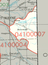
The United States Geological Survey has assigned the Auglaize Watershed an 8-Digit Hydrologic Unit Code of 04100007.