
Whitewater Watershed
Watersheds: Whitewater
Whitewater Watershed
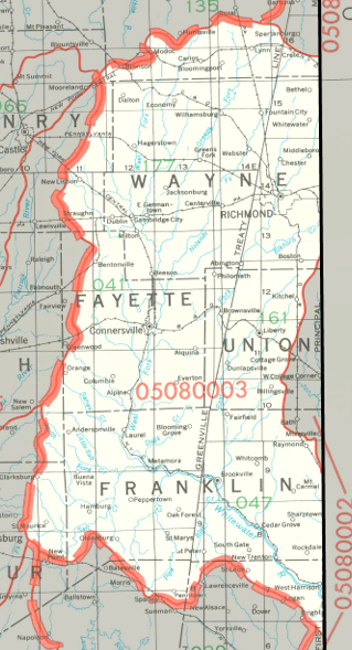
The Whitewater Watershed drains about 943,000 acres, roughly ninety percent of which are in Indiana; the rest are in Ohio. The watershed is centered on the Whitewater River, which flows south in the southeastern part of Indiana. It drains nearly all of Fayette County, Franklin County, Union County, and Wayne County, and smaller portions of six other Indiana counties. The Whitewater River is popular with canoeists and kayakers because while there is no real white water, there are rapids.
County |
Acreage |
Source: USDA
The Whitewater River flows in a generally southerly direction and crosses into Ohio, quickly joining the Great Miami River a few miles above the latter's confluence with the Ohio River. The Ohio River flows into the Mississippi River, which discharges into the Gulf of Mexico.
The United States Geological Survey has assigned the Whitewater Watershed an 8-Digit Hydrologic Unit Code of 05080003.