
Upper East Fork White Watershed
Watersheds: Upper East Fork White
Upper East Fork White Watershed
Click to enlarge
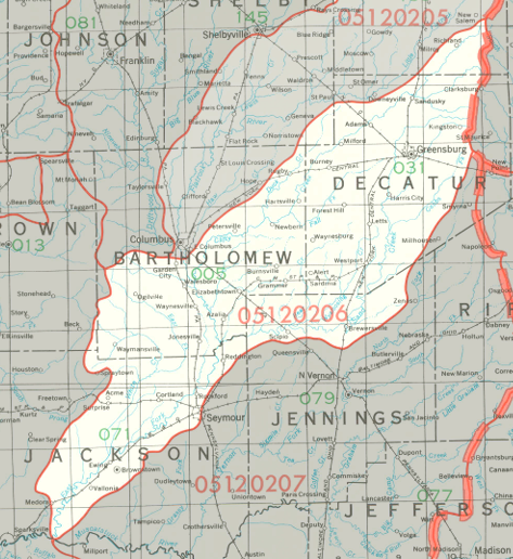
The Upper East Fork White Watershed is centered on the Upper East Fork of the White River, which extends in a generally southwestward direction from southeastern Rush County to southwestern Jackson County. The watershed drains most of Decatur County, large portions of Bartholomew County and Jackson County, and smaller parts of four other counties. The watershed is restricted to Indiana, and drains about 519,000 acres.
County |
Acreage |
Source: USDA
Notable tributaries of the Upper East Fork of the White River include White Creek, Sand Creek, the Driftwood River, and the Flatrock River.
The White River joins the Wabash River, which flows first into the Ohio River, then into the Mississippi River before discharging into the Gulf of Mexico.
The United States Geological Survey has assigned the Upper East Fork White Watershed an 8-Digit Hydrologic Unit Code of 05120206.