
Flatrock-Haw Watershed
Watersheds: Flatrock-Haw
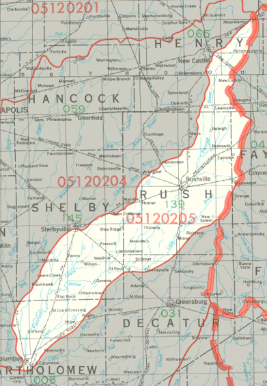
Flatrock-Haw Watershed
Click to enlarge
The Flatrock-Haw Watershed extends from an area just east of New Castle in Henry County down to Columbus in Bartholomew County. Along the way it drains parts of Fayette County, Rush County, and Shelby County. Haw Creek joins the Flatrock River just south of Columbus. The watershed drains about 383,000 acres, all in Indiana.
County |
Acreage |
Source: USDA
Ben Davis Creek, Shawnee Creek, Shankatank Creek, and the Little Flatrock River are all part of the Flatrock-Haw Watershed.
The Flatrock River flows into the East Fork of the White River, and continues to the White River, Wabash River, Ohio River and Mississippi River before discharging into the Gulf of Mexico.
The United States Geological Survey has assigned the Flatrock-Haw Watershed an 8-Digit Hydrologic Unit Code of 05120205.