
Versailles
State Park
Natural Areas: Versailles State Park
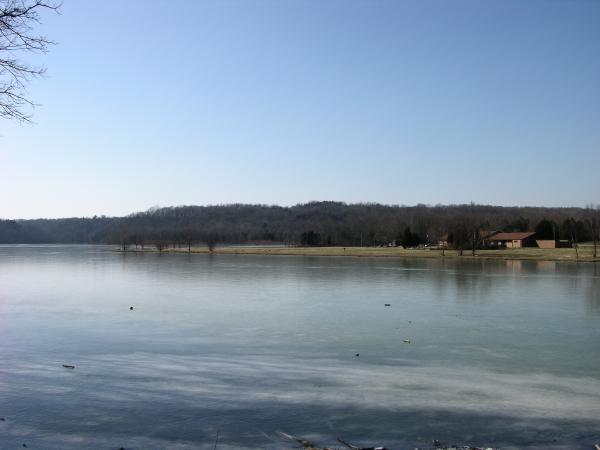
Lake. Click to enlarge
Versailles (pronounced Ver-Sales) State Park comprises nearly 6,000 acres, which makes it the second largest of Indiana’s State Parks. The central feature is a reservoir formed by damming Laughery Creek. Trail 1, a two-mile loop, is my favorite trail in the park. It explores forested ridges and ravines south of the campground; in doing so, it passes several small sinkholes. Trail 3 is a long-stemmed lollipop; the stem spends much of its distance crisscrossing Fallen Timber Creek. It’s scenic enough but may be tough on ankles. Trail 2 (three miles) ventures too close to the campgrounds for my taste. There are also well over twenty miles of mountain bike and bridle trails north of the reservoir and Fallen Timber Creek that are open to hikers but which I have not explored.
Directions
Ripley County. From US 50 X US 421 in Versailles, go east 1.3 miles on US 50 to the park entrance on the left. (Fee)
GPS: N 39 03.695 W 85 14.047
Facilities
Campground, small nature center, more.
Finder Sketch
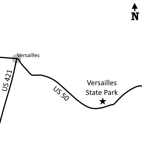
Click to enlarge
Nearby Natural Areas (miles)
No profiled areas within 20 miles