
Sycamore Loop
Natural Areas: Sycamore Loop
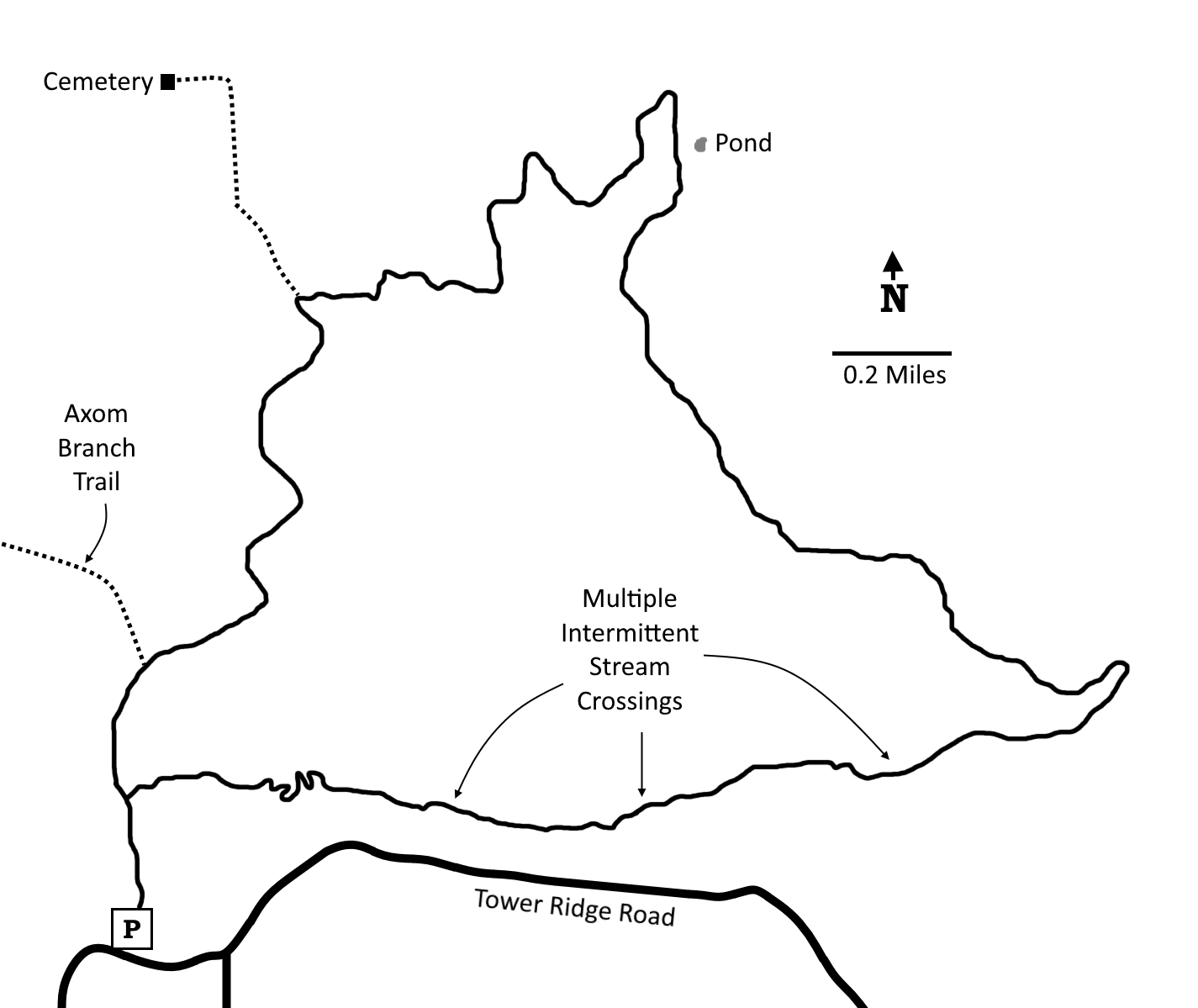
The Hickory Ridge trailhead (N 39 02.067 W 86 19.265) is the jumping-off point for the Sycamore Loop. The trailhead is a very popular stop in its own right because of the fire tower adjacent to the parking area, which you can climb for amazing views of the surrounding forest. I prefer to get most of the “road” walking out of the way first by following the trail (which along this stretch is an old lane) in a generally north direction for about a mile and a half, toward the Terrill Cemetery, then turning right as the lane to the cemetery continues north. This is probably the least-used portion of the loop, as it’s definitely the long way to most of the designated camping spots. The path remains fairly level as it works its way around large and steep-sided ravines. After the trail turns south, look for isolated Camp 5, just to the east between the trail and a small pond. There are times when you can’t even hear an internal combustion engine along this stretch – a rarity in Indiana. Eventually the trail descends into a small valley partially filled with pines. As the valley broadens and the canopy transitions to large sycamore trees, the trail passes several designated campsites, crossing and re-crossing the (typically) dry streambed of Sycamore Creek. This is a very popular camping area, and if you choose to overnight here you are likely to have lots of (potentially noisy) company. From this area it’s a relatively quick climb up and out via several short switchbacks to rejoin the old lane, then left back to the parking area.
Trail Map
Click to enlarge
Directions
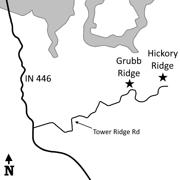
Monroe County and Brown County. From the intersection of IN 46 and IN 446, go south 12.3 miles on IN 446, then turn left on Tower Ridge Road. Proceed 6.1 miles to Hickory Ridge.
Facilities
None
Finder Sketch
Click to enlarge