
Ropchan Wildlife Refuge
Natural Areas: Ropchan Wildlife Refuge
State Designated Nature Preserve [#57; 1980]
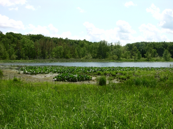
Cemetery Lake. Click to enlarge
Ropchan Wildlife Refuge consists of parcels owned by ACRES Land Trust as well as a Wetlands Conservation Area owned by the Indiana DNR. The preserve seems to have a bit of nearly every habitat found in this region. It is home to a kettle lake, a stream, meadows, marshy areas, old overgrown fields, and upland forest. There are also several kames – mounds of sand and gravel left behind by melting glaciers. Nevertheless, the overall ambiance is of a farm allowed to revert to nature.
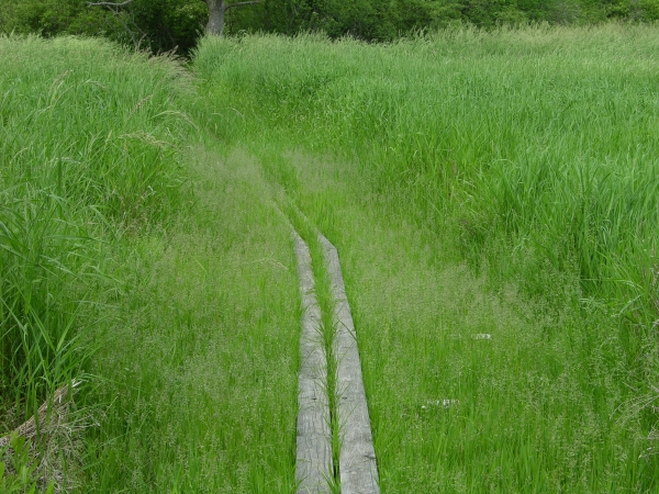
Puncheon Trail. Click to enlarge
Though the preserve contains what is certainly the largest bloodroot (facing, bottom) patch I’ve ever seen, overall wildflower variety and density at least superficially seems on the low side, particularly in dry years. However, Indiana DNR literature states that the preserve is home to several plant and animal species otherwise rare to Indiana, including tamarack, yellow birch, star-nosed mole, massasauga rattlesnake, and Blanding’s turtle. The wetter areas are probably your best (if unlikely) bet for seeing most of those; my own attempts have failed.
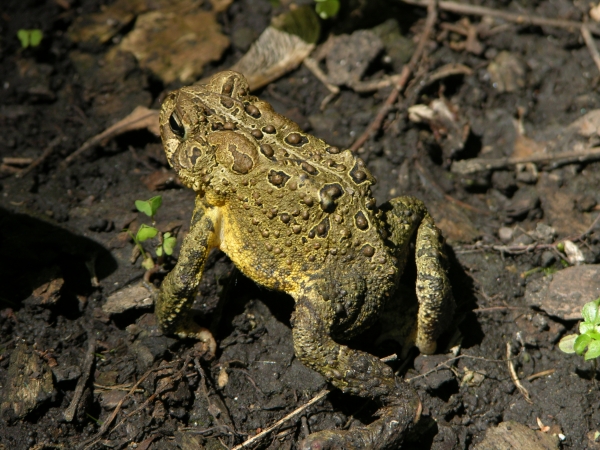
Toad. Click to enlarge
Cemetery Lake and its associated cemetery carve out a large area in the middle of the preserve, and a prominent stream or ditch that both feeds and drains the lake divides the property into roughly equal north and south halves. A sprawling and complex trail system totaling at least three miles explores much of the preserve. Sporadic color-coded posts mark various paths, and though it likely won’t be apparent to you when you visit, the general layout is something like a large loop that circles the lake and cemetery, with numerous side loops attached to each other, mostly in the northern and northeastern parts of the preserve.
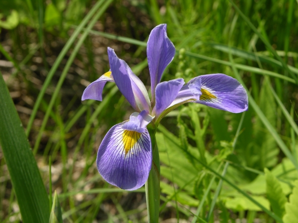
Blue Flag Iris blossom. Click to enlarge
My best advice is to wander around, take your time, and see what you find. A thorough exploration will take several hours at least. While potentially confusing, the trail system is well-maintained and you shouldn’t get lost for long. Interstate 80 borders the southern edge of the preserve and the resulting noise can be continuous and annoying, while large and visually obtrusive buildings press against the northern boundary. On the positive side, those “features” may help you orient yourself as you explore. This preserve certainly isn’t my favorite in the region, but size and habitat variety make up for its shortcomings.
Trail Map
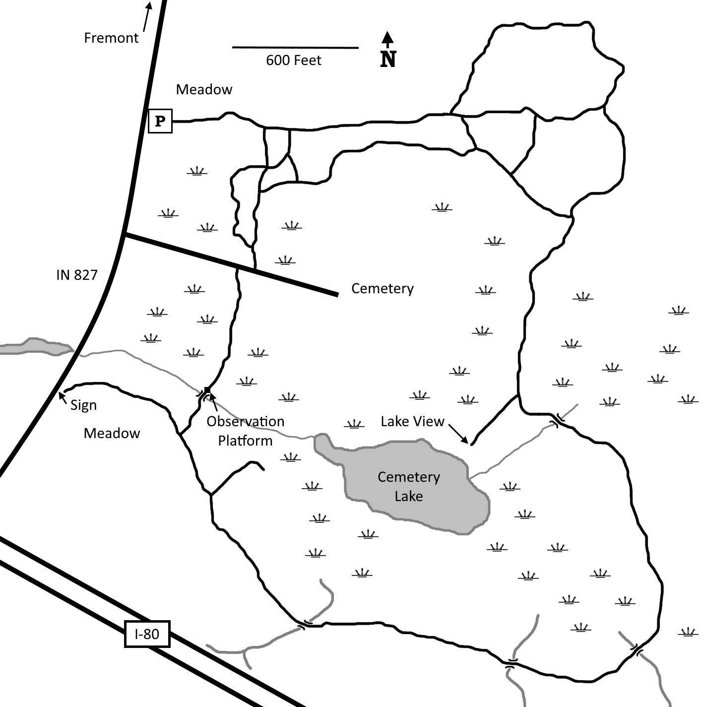
Click to enlarge
Directions
Steuben County. From the intersection of IN 120 and IN 827, south about a mile on IN 827 to a parking area on the east side of the road.
GPS: N 41 42.958 W 84 56.205
Facilities
None
Finder Sketch
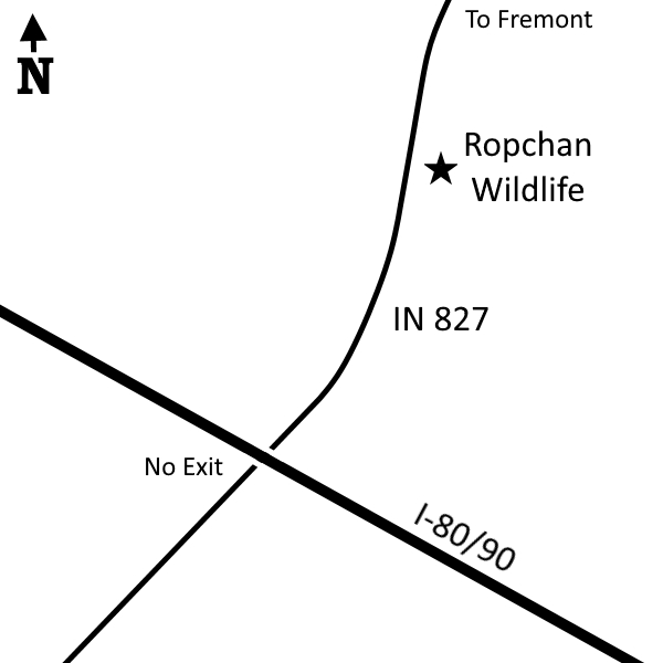
Click to enlarge