
Pokagon State Park
Natural Areas: Pokagon State Park
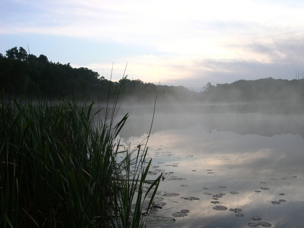
Sunrise fog at Lake Lonidaw. Click to enlarge
Pokagon State Park comprises about 1,200 acres, partially bounded by Lake James and Snow Lake. There is an Inn with all sorts of amenities and an excellent nature center, but the park’s most famous feature may be the refrigerated toboggan run that operates during the winter months. Lake James is very popular with recreational boaters, who often tie their vessels together in vast party rafts. Occasionally, boaters come ashore, coolers and all. The sound of racing engines and revelry can carry great distances over water, and that tends to drive me away from the shore during the summer.
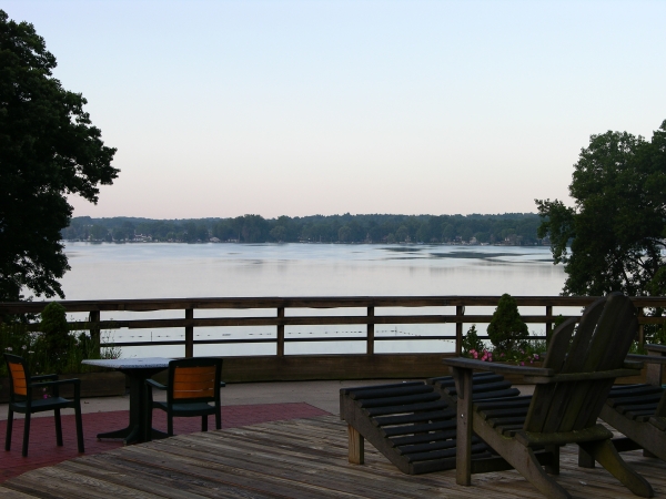
View from the Inn. Click to enlarge
Fortunately, there are some good alternatives. Trail 3 starts at the Inn parking lot and heads east toward the Potawatomi Nature Preserve. A short out-and-back trail leads to a floating dock that looks out on Lake Lonidaw, a kettle hole lake that is about 35 feet deep. It can be a wonderful place to watch the day begin, as mists rise from the lake and the day world comes alive. Lucky springtime visitors to the preserve may also see the amazing yellow lady’s slipper orchid growing in wet areas along the boardwalk. I’ve never seen spectacular wildflower displays at Pokagon like those present at some other locations in northeastern Indiana, but DNR’s wildflower checklist for the park (see if the Nature Center has a copy) lists 245 species, so variety is excellent.
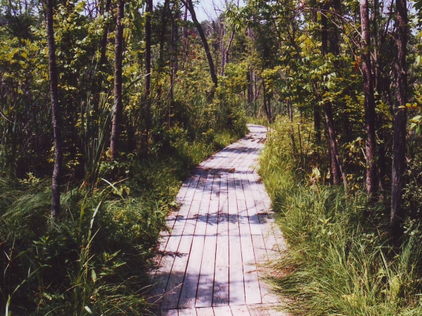
Boardwalk along Trail 3. Click to enlarge
Trail 6 is a side loop of Trail 3; it skirts wetlands between Lake Lonidaw and Lake Charles; the latter is surrounded by private homes that are surprisingly unobtrusive. Trail 3 continues north, first crossing the park entrance road (careful!) then climbing to Hell’s Point, 135 feet above Lake James. There’s a viewing platform here; after descending a long flight of stairs, the trail heads west then south, back toward the Inn. Along the way, it intersects with Trail 7, a two-mile lollipop that allows access to a mostly open area and restored lake on the north end of the park.
Trail 9 is a short-stemmed lollipop attached to Trail 3; it explores areas to the east. It ventures too close to I-69 for my taste but offers some nice bloodroot patches on higher ground. Trail 2 heads north, toward Snow Lake. You’ll pass unfortunately close to the wastewater treatment plant, but if you visit late in the day views of the sunset over Snow Lake will likely compensate.
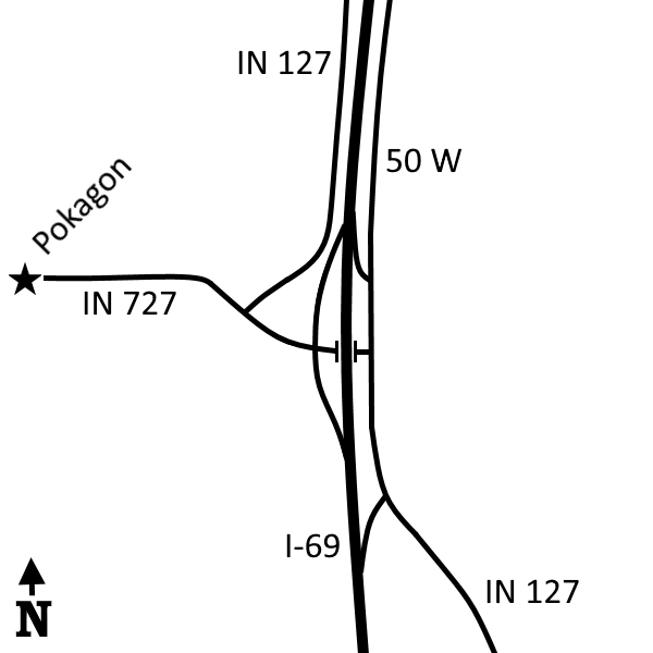
Directions
Steuben County. From I-69 Exit 354, look for prominent signs that will direct you to the park. (Fee)
GPS: N 41 42.456 W 85 01.358
Facilities
Inn, food service, campground, showers, bathrooms, nature center
Finder Sketch
Click to enlarge
Nearby Natural Areas (miles)
Beechwood Nature Preserve (1.6)
Wing Haven Nature Preserve (2.1)
McClue Nature Reserve (2.7)
Marion's Woods (5.7)
Loon Lake Nature Preserve (8)
Ropchan Memorial Nature Preserve (10.1)
Robb Hidden Canyon Nature Preserve (15.5)
Fawn River Nature Preserve (16.7)
Douglas Woods (19.1)