
Hemlock Cliffs
Natural Areas: Hemlock Cliffs
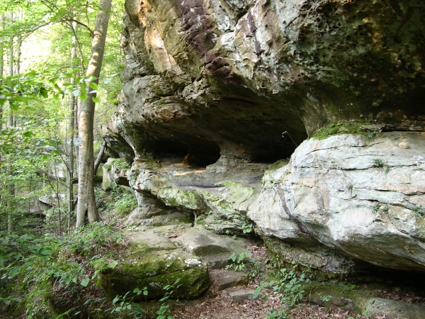
Rock Shelter. Click to enlarge
Hemlock Cliffs features spectacular rock formations, including the longest vertical drop in the state – about 150 feet. Native Americans used rock overhangs and caves in the area for shelter, and there are still fading signs of their long-ago presence. Several species associated with more northern climes occur here – mountain laurel, wintergreen, and of course hemlock trees, some of the latter quite large. The site is also home to French’s Shooting Star, a wildflower found only in scattered locations across a few southern Indiana counties.
Pick up a trail map at the information sign next to the parking area and head down the path. It’s a loop of just over a mile, marked with white diamond blazes. You’ll descend a set of timbered steps that lead to a notch in the rocks; once there, pause to take in the view. I recommend against trying to simultaneously walk and gape anywhere in this preserve; in some places, a slip could have dire consequences. After passing through the notch you’ll continue down a series of stone steps, some natural, some placed, and eventually wind up along an intermittent stream. The temperature will likely be markedly lower - a fact that may help explain the presence of so many plants typically found to the north.
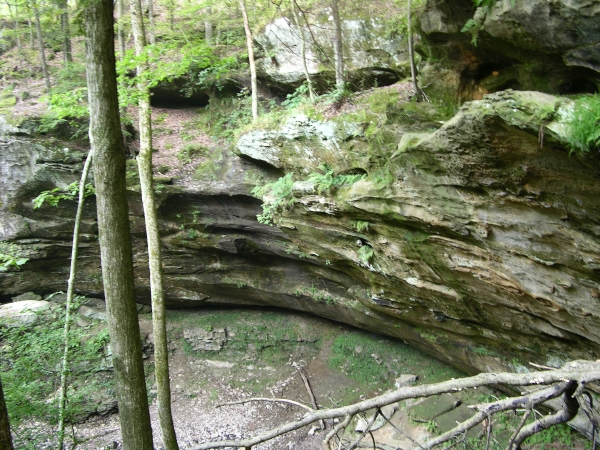
Outcrop. Click to enlarge
Walk down the stream bed. You may encounter isolated pools of water, some with fish trapped in them. Tall cliffs loom to your right, some perhaps a hundred feet high. At the junction, turn right onto a side loop that ventures into an area marked No Rappelling. The scenery here will not disappoint. The return path is along the valley of an intermittent stream; nice rock formations appear at intervals on either side of the trail before it turns left and begins its climb out of the canyon.
Trail Map
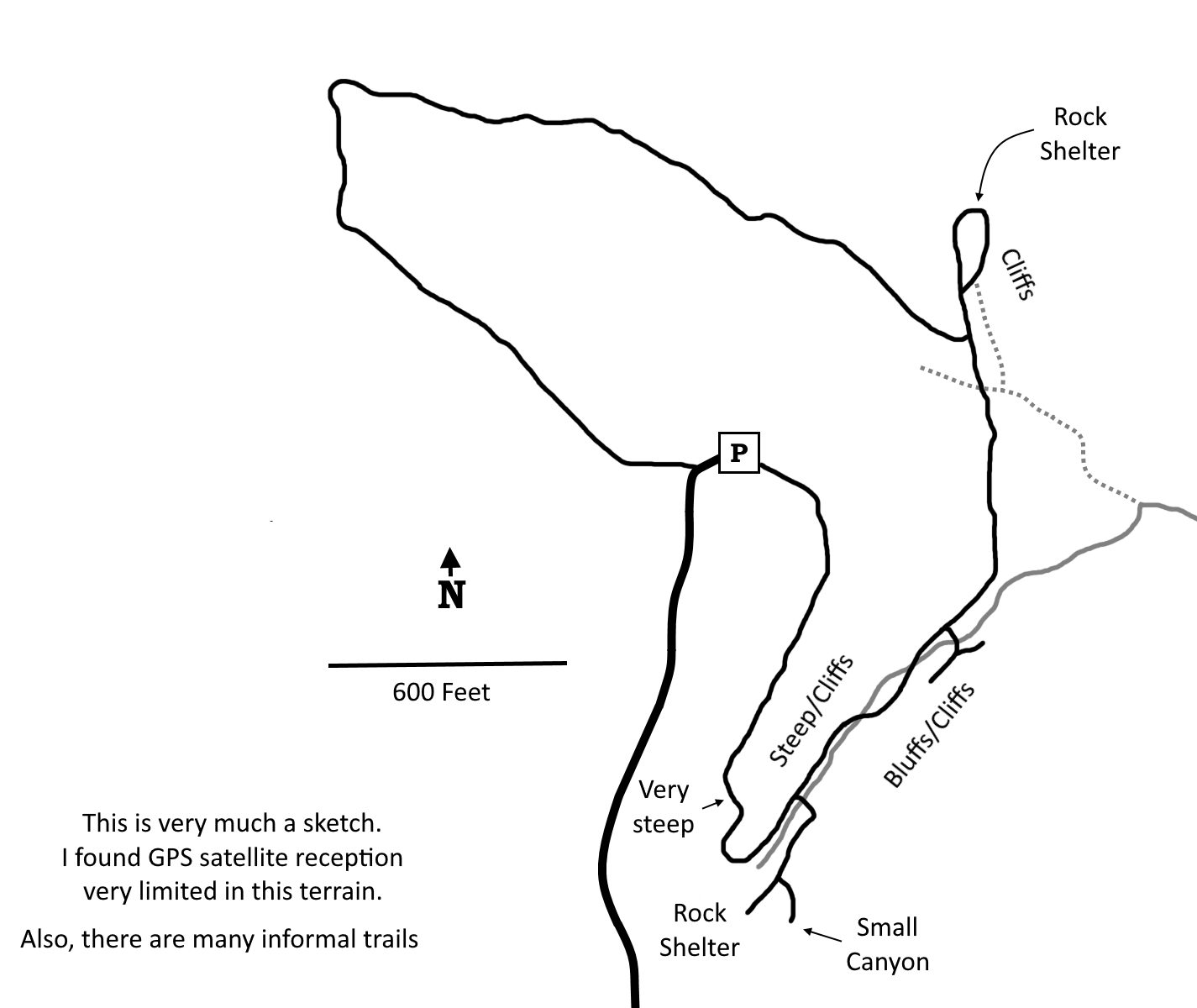
Click to enlarge
Directions
From I-64 Exit 86: North 2.7 miles on IN 237 to Union Chapel Rd, then left 2.6 miles to Hatfield Rd, then right 1.6 miles. Continue straight as Hatfield goes left; the last 0.4 miles are on a US Forest Service Road.
From I-64 Exit 79: North 4 miles on IN 37 to Bethany Church Rd, then right 1.5 miles where the road turns sharply right and merges into Mifflin West Fork Rd. Continue 1.3 miles, the road will become Pleasant Ridge East Rd and then “T” at Hatfield Rd. Turn right, go 0.6 miles, then left on the USFS Road to Hemlock Cliffs.
GPS: N 38 16.650 W 86 32.334
Facilities
None
Finder Sketch
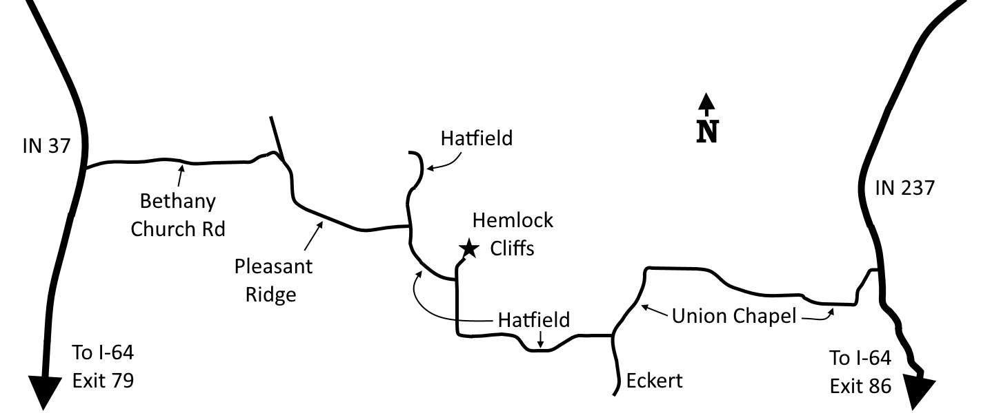
Click to enlarge
Nearby Natural Areas (miles)
Two Lakes (10.6)
Newton-Stewart State Recreation Area (12.6)
Tipsaw Lake (15.3)
Leavenworth Barrens (18.5)
Buzzard Roost (19.5)