
Crooked Lake
Natural Areas: Crooked Lake
State Designated Nature Preserve [#47; 1978]
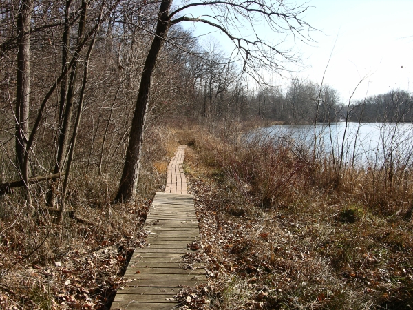
Trail along Crooked Lake. Click to enlarge
Crooked Lake offers two loop trails through upland woods and along the shore of a scenic lake. Park and pass through the stile. As you continue down the path; don’t be surprised if one or more friendly local dogs join you. The path heads south through what looks like an old field that has grown up in trees. Bear left at the fork and continue past a large barn. The trail soon veers right and begins to descend toward the lake along an old lane. Starry Solomon’s seal occurs around the registry box. Sign in and, if available, pick up a copy of the detailed trail brochure. From here, trails lead either left or right.
The path to the left (east) follows the lake shore; it is muddy in spots and uses planks to cross some of the wetter areas. On occasion, I’ve found the trail inundated. The path affords an opportunity to appreciate the exceptionally clear water, and the lake setting is very attractive, though the presence of several homes on the south shore detracts somewhat from the view. After a time, you’ll veer away from the lake shore and head left into the woods, then double back and begin climbing onto a ridge line adjacent to the lake. The trail follows this narrowing ridge line, and passes a small, dilapidated and rather forlorn cemetery on the left. Eventually the loop descends along the ridge line and ends at the registry box.
The path to the right (west) also shadows the lake shore for a few hundred yards; at one point, it becomes a boardwalk and passes through a nice patch of horsetail. Watch for downed trees and other signs of beaver activity; several of these large, primarily nocturnal animals live here. Eventually you’ll reach a junction. Heading straight leads through a recent addition to the preserve, ending at what looks like a parking lot; you’ll need to retrace your steps. Back at the junction, another trail turns away from the lake and climbs the adjacent hillside. It then angles back toward the main access trail, returning to the first junction you encountered on entering the preserve. Though the lakeside portions of the trails are prone to flooding, the peaceful and beautiful surroundings make this one of my favorite destinations in this part of the state.
Trail Map
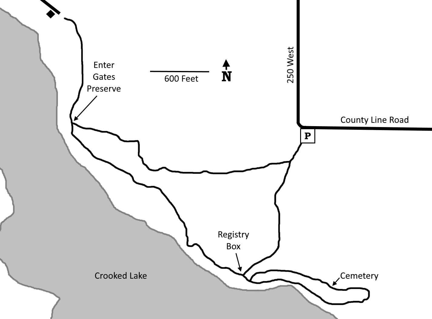
Click to enlarge
Directions
Whitley County. From the intersection on US 33 and IN 9, south/ southwest about 2.2 miles in IN 9, then west on Noble/Whitley County Line Road for about one half mile to a parking area on the left (south).
GPS: N 41 15.915 W 85 28.296
Facilities
None
Finder Sketch
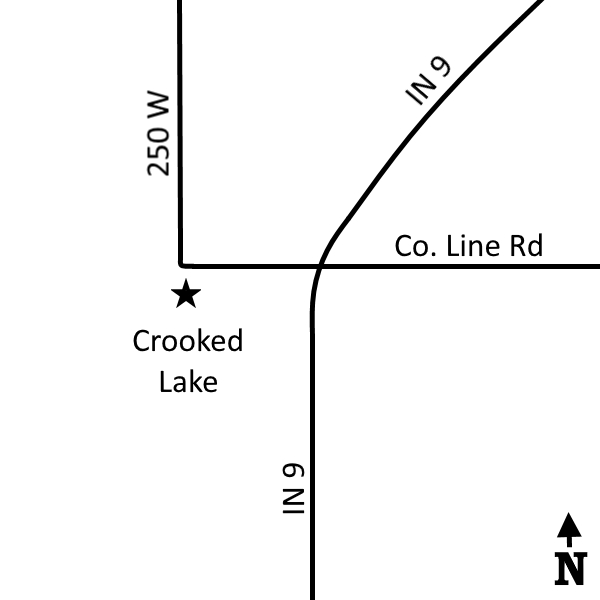
Click to enlarge
Nearby Natural Areas (miles)
Dygert Nature Preserve (5.3)
Merry Lea (5.6)
Chain O'Lakes State Park (7.6)
Bender Nature Preserve (11.9)
Greider's Woods (15.4)
Spring Lake Woods and Bog Nature Preserve (15.6)
Spurgeon Woodland Reserve (19.6)
Bicentennial Woods (19.9)