
Acres Along the Wabash
Nature Preserve
Natural Areas: Acres Along the Wabash
State Designated Nature Preserve [#26; 1973]
Trail. Click to enlarge
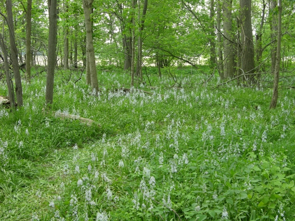
Acres Along the Wabash Nature Preserve is a very scenic preserve with substantial Wabash frontage and spectacular spring wildflower displays. Two trails lead from the parking area to the Wabash – an accessible gravel trail, and a parallel footpath just to the west of the first that passes large-flowered trillium in May. On reaching the Wabash, trails lead both upstream and downstream. If you head downstream, the trail hugs the bank awhile before reaching a large patch of wild hyacinth. It then turns away from the river and loops back toward the parking area. In spring, watch for shooting star along the riverbank and generous patches of Miami mist.
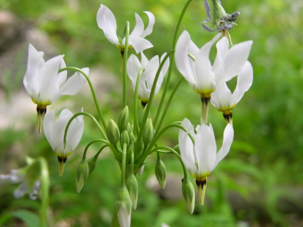
Shooting Star. Click to enlarge
If you head upstream, you’ll follow the riverbank for several hundred feet before encountering a series of connected loops. There’s a large loop that circles recently planted trees (not of tremendous interest, yet), and a series of smaller loops, some of which are home to more mature trees closer to the river. The upstream trails terminate in a lollipop that passes through a stupendous patch of wild hyacinth. In spring, these flowers bear clusters of pale blue flowers on racemes about two feet high. Thousands are present, pressing in against the path that at times passes directly through them, so that it may become impossible not to step on and crush flowers as you pass.
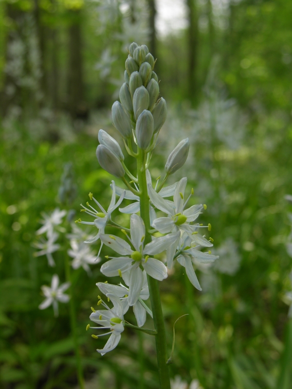
Wild Hyacinth. Click to enlarge
The Wabash is still relatively small here, barely larger than a good-sized creek, but in some ways that just adds to the appeal. This is without doubt one of my favorite nature preserves in this part of the state, and unless pressed for time I typically linger to soak up the ambiance, even to the point of finding some excuse to walk the trails a second time.
Trail Map
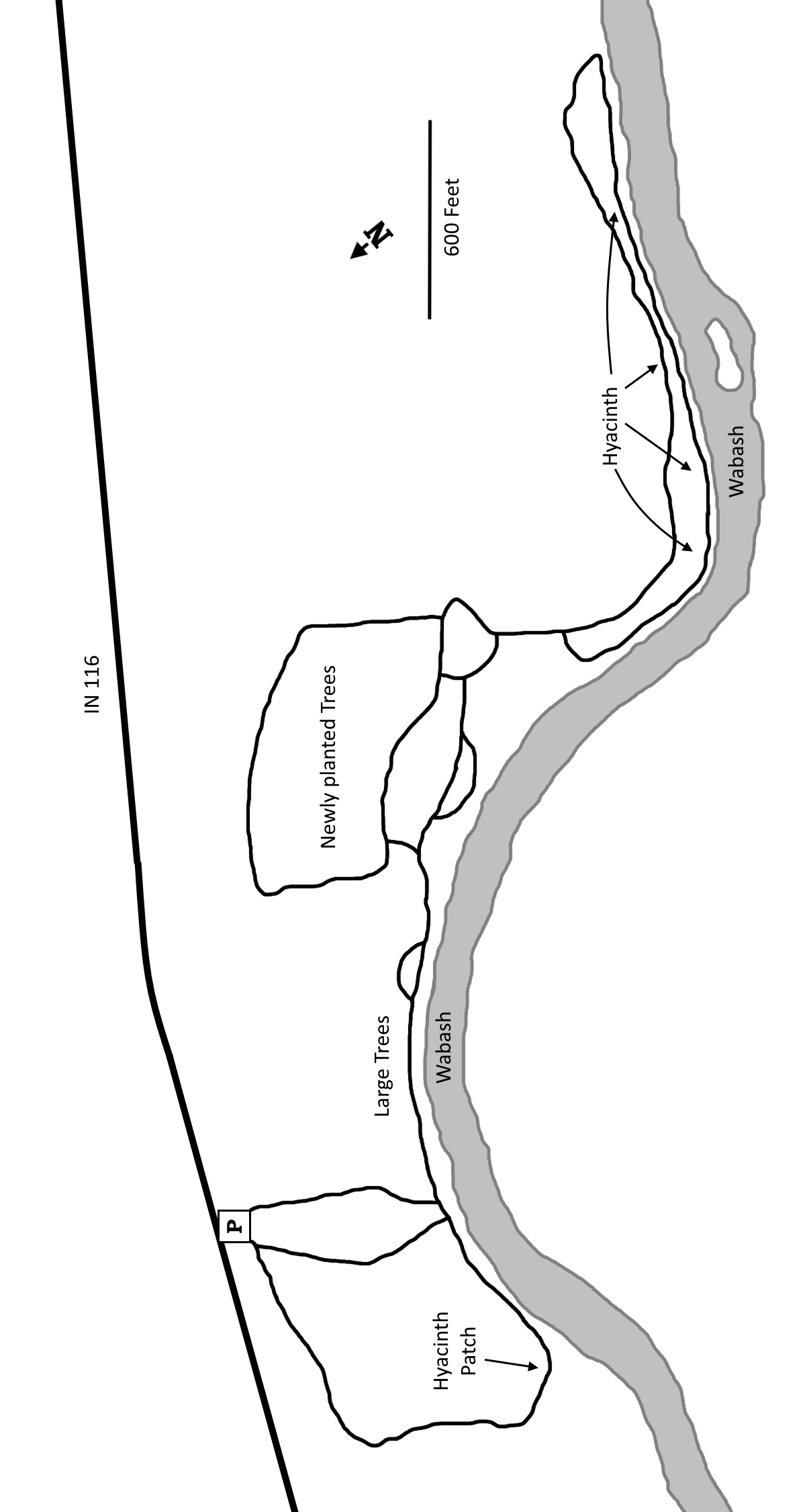
Click to enlarge
Directions
Wells County. From the intersection of IN 1 and IN 224, west 3.0 miles to Meridian, then south 1.8 miles to IN 116. From there, go east 0.25 miles to the parking area entrance on the right.
GPS: N 40 48.157 W 85 13.138
Facilities
None
Finder Sketch
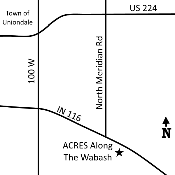
Click to enlarge
Nearby Natural Areas (miles)
Ouabache State Park (10.9)
Baltzell-Lenhart Nature Preserve (17.0)
Tel-Hy Nature Preserve (17.4)
Fogwell Forest (18.3)
Pehkokia Woods (18.5)
Fox Island County Park (19.5)